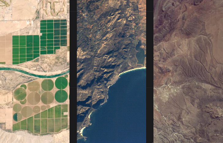
Earth observation technologies are an effective tool for collecting agricultural data and tracking environmental changes. They enable monitoring selected zones to accurately detect destructive effects of human impact. Examples of remote sensing applications include monitoring deforestation, glacier conditions, ocean depth measurement, crop type classification, soil and yield conditions and more. Multispectral imagers are key elements of earth observation systems. Remote sensing provides agricultural and analytics companies with high-resolution images. With accurate and timely data from multispectral imagers, farmers can more efficiently manage their fields and monitor crop conditions, saving both time and money.
- Using satellite crop monitoring saves up to 10% annually on fertilizer.
- Satellite agriculture monitoring means fewer trips around the field to control crop development, saving fuel – up to 40% per hectare.
- Satellite yields tracking provides information on nitrogen levels in the soil, analyzing vegetation indices and deviations for a particular field, saving $0.4 per hectare annually.
Remote Sensing in Agriculture: Case
Dragonfly’s product line includes 6 high-resolution multispectral imagers, tailored to the needs of agricultural monitoring with remote sensing and tracking environmental changes. Recently, global satellite analytics company EOS Data Analytics contracted Dragonfly to supply two HR-250 multispectral imagers. EOSDA plans to explore the potential of HR-250 within their true-agricultural satellite constellation. The imaging satellite will be launched into Low Earth Orbit (LEO) in early 2022.
EOS Data Analytics will use the data obtained with the help of Dragonfly’s HR-250 for numerous cases of agriculture monitoring, such as harvest monitoring, yield prediction, variable-rate application mapping, soil moisture and biomass assessment, season planning and more. By combining proprietary satellite data with in-house analytics solutions, the company strives to achieve wider coverage and better analysis capabilities for its clients.
In addition to focussing on agriculture, EOS Data Analytics plans to employ their future constellation for environmental protection, forestry, oil & gas management, mining, and many other purposes.
Solution
HR-250 is part of a new generation of high-performance lightweight imagers for environmental monitoring and imaging. The imager is designed to be installed side by side to cover a 44km swath from 500km. It will provide wide area coverage which is especially useful for the commercial agricultural industry. The HR-250 has 10 highly specific spectral bands optimized for agricultural satellite imaging and resource monitoring with a native resolution of 1.4m. These bands will enhance segmentation and classification of both land and coastal/aquatic features. This resolution in a compact instrument is achieved by using a highly optimised optical design in line with a relatively small pixel detector. High-resolution agriculture satellite imagery will provide more accurate data for environmental tracking. For example, it is crucial to accurately identify species within a forest or field. With high resolution imagery farmers can monitor the crop health and detect potential risks. It allows quick response to problem areas, maximizing the yields salvaged. The data will be updated 5-7 times more often than market solutions, enabling farmers to monitor and react more efficiently.
Multispectral imagers are an effective instrument of remote sensing in agriculture for performing precision farming and tracking environmental changes. High-resolution cameras provide data analytics companies with up-to-date information so that they can respond to real challenges for different applications, especially in the agricultural industry.
