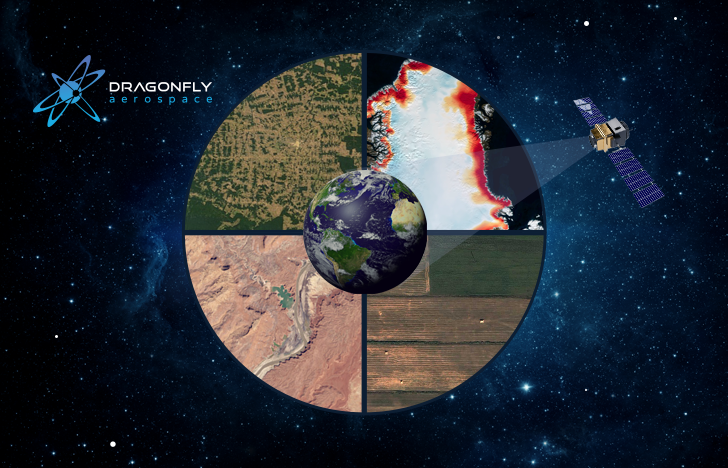
As technologies advance, humanity is increasingly influencing the planet and nature. We consume more and more resources to meet our needs. At first glance, humanity may not notice the impact it brings to the Earth. But if we view our planet from above we can see how our home changes over time. With the help of earth observation technologies, we can monitor and reduce the negative impact that we have on nature. In honour of International Earth Day, we would like to share our observations of the most urgent challenges on our planet that remote sensing can help solve.
Using Earth Observation to Monitor Deforestation
Deforestation has become one of the most dangerous problems on our planet. Over the past 20 years, we have lost enough tropical forests to cover the whole of France. By using remote sensing, we can monitor the progress of deforestation and slow down this negative process through global action. Accordingly, satellite image data analysis companies can predict the area of possible deforestation. Knowing the possible deforestation zone, we can send teams in the field to investigate illegal activities and engage with the parties involved. In addition, companies may stop sourcing wood from problem areas, which may slow down the demand for these natural resources and stop this negative process in a particular region.
Pond Shrinkage
Water is one of the most vital resources on our planet. We use more and more water from natural ponds to meet our needs. This can often lead to a reduction of the pond volume and in the end to a permanent loss of water area. An example of such destructive human impact is the Aral Sea lake. This lake was once the fourth largest in the world. But in the 1960s, farmers and local government diverted significant amounts of water from the rivers feeding the lake in order to irrigate cotton and rice fields. As a result of the diversions, the surface area of the lake decreased from 67,500 sq km in the early 1960s to only 13,900 sq km in 2010. The shrinking of the Aral Sea has led to the disappearance of the fishing industry and to shifts in climate in the region. In 2005, local authorities built a dam between the northern and southern parts of the Aral Sea resulting in a visible increase in water level.
With the help of satellite imagery, we can map abandoned shorelines of ponds. Studies revealed that the Sahara was green and alive in the past with a lot of lakes. In the past, there was “Mega Chad”, the largest freshwater lake on Earth, which covered 360,000 square km. By 2020, it was reduced to a fraction of its former size of 1,540 sq km. Human influence along with climate change has turned the Sahara into a barren desert. The growing human population near Lake Chad aids in its shrinking size and loss of vegetation in its coastal areas. Lake Chad plays a vital role in supplying fresh water to many African communities. To combat the shrinking of the lake, local authorities and international organizations have established the Great Green Wall initiative. This includes a plan to grow 8,000 km of trees and vegetation that will improve rainfall patterns and help restore the region’s ecological stability.
Ice Loss
Ice regions are huge and difficult to access. It is only through satellite images that we gain a better understanding of the ice sheets. 200 gigatons of ice per year from the Greenland ice sheet melts into the oceans, which is enough to raise sea level by about two-thirds of a millimeter per year. Scientists have discovered that the net loss of ice from Antarctica, along with the shrinking ice cover in Greenland, is responsible for a 14 millimeters rise in sea level between 2003 and 2019. Data obtained by scientists from ICESAT-2 reveal that the Greenland ice sheet is shrinking near the coastal area, but thickens in the centre of the island. This is caused by the ocean and atmospheric conditions all around the edges of Greenland. At the same time, we notice a rapid loss of ice in the western Antarctic region. Most of this is caused by changes in the ocean heat flow under the ice shelves. The destruction of the ice base causes a rapid thinning of the glacier.
Earth Observation Application for Precision Agriculture
Earth observation technologies have paved the way for the smart use of agricultural fields. Satellite imagery allows farmers to manage their farms efficiently. Dragonfly Aerospace follows the trend of precision agriculture. With EOS DA, we will deliver two HR-250 high-performance multispectral imagers into low Earth orbit (LEO) in early 2022. The main focus of this mission is to provide farmers and agricultural businesses with fast, precise data. With visual data from the imagers, farmers will be able to accurately monitor and analyze critical indicators of soil and yield conditions. Globally, precision agriculture can help us to reduce the cost of food production, identify the most suitable areas for fields and contribute to the fight against hunger.
Earth observation data, of course, cannot directly solve all the problems we have on our planet. But with the help of satellite imagery, we can discover the cause of certain phenomena and see changes on our planets on a global level. Based on satellite data, we can make smart decisions to improve life and save nature on our Mother Earth. It would not be possible without precision cameras. At Dragonfly Aerospace, we are proud to be part of the earth observation community that works together in combating the challenges of our planet.
